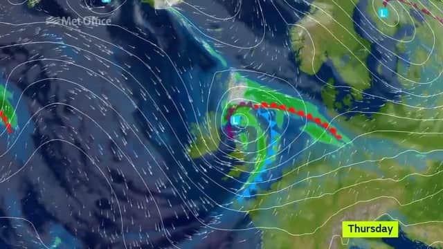
Storm Doris now a "weather bomb" as it approaches Rotherham


The Met Office said the storm had “rapidly deepened” over the last 24 hours creating more violent winds.
It said wind gusts of up to 80mph could hit the borough, causing widespread travel disruption.
Advertisement
Hide AdAdvertisement
Hide AdDamage to property and further disruption is also possible throughout the day.
An amber weather warning remains in place until around 8pm on Thursday, with the worse of the storm still to hit.
#StormDoris has rapidly deepened over the last 24 hours as it has under gone what we call Explosive Cyclogenisis making it a #WeatherBomb pic.twitter.com/U7VI7WDGtT
— Met Office (@metoffice) February 23, 2017A Met Office spokesman said: “While the strongest winds look to be only short-lived, damage to structures, interruptions to power supplies and widespread disruption to travel networks are likely, with a danger of injury from flying debris. Trees are also likely to be damaged or blown over.
“Heavy rain is also likely through Thursday as well as some snow over high ground as the system clears eastwards. These may prove additional hazards.”
Advertisement
Hide AdAdvertisement
Hide AdA weather bomb is when air flows quickly into a low pressure area, causing the air to rapidly rotate.
When the pressure increases, this becomes a ‘weather bomb’.
The science behind it says that to be considered a weather bomb, the central pressure of the storm system, must dip by 24 millibars in a 24 hour period.