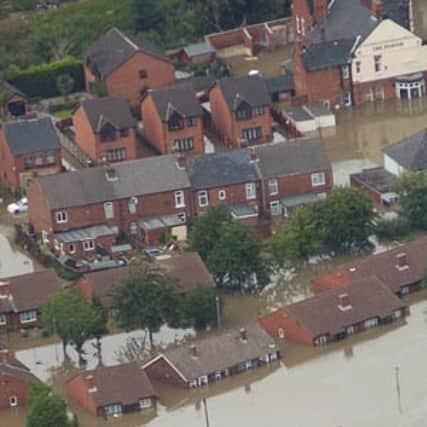
Report highlights 100 Rotherham flood hotspots


More than 100 flood risk hotspots in the town could be in line for anti-flooding work after being highlighted in Rotherham Borough Council’s Preliminary Flood Risk Assessment.
The report concluded that more than 8,500 residential properties in the town are potentially at risk from surface water flooding, while less than 300 properties could be deluged by flooding from rivers.
Advertisement
Hide AdAdvertisement
Hide AdThe report, which has been published on the council’s website and was compiled in line with new Government legislation, comes four years after the borough hit the national headlines when hundreds of homes were washed by flash flooding following several days of torrential rain in June 2007.
New legislation requires the council as the lead local flood authority to carry out a Preliminary Flood Risk Assessment looking at the local sources of flood risk, such as surface water run-off, groundwater and ordinary watercourses.
The council has now submitted the Preliminary Flood Risk Assessment to the Environment Agency.
It will be sent to the Department for Environment, Food and Rural Affairs (DEFRA) for approval later this month, before adopted as the Final Preliminary Flood Risk Assessment for Rotherham.
Advertisement
Hide AdAdvertisement
Hide AdThe next stage of the process involves preparing flood hazard and risk maps by 2013, while flood risk management plans are expected to be drawn up by 2015.
The and report is now available at: www.rotherham.gov.uk/info/200039/emergencies/2179/preliminary_flood_risk_assessment and can also be accessed from the main Emergency Planning page at www.rotherham.gov.uk/info/200039/emergencies.